
Greetings from Silverton on Thursday afternoon, February 26, 2015-
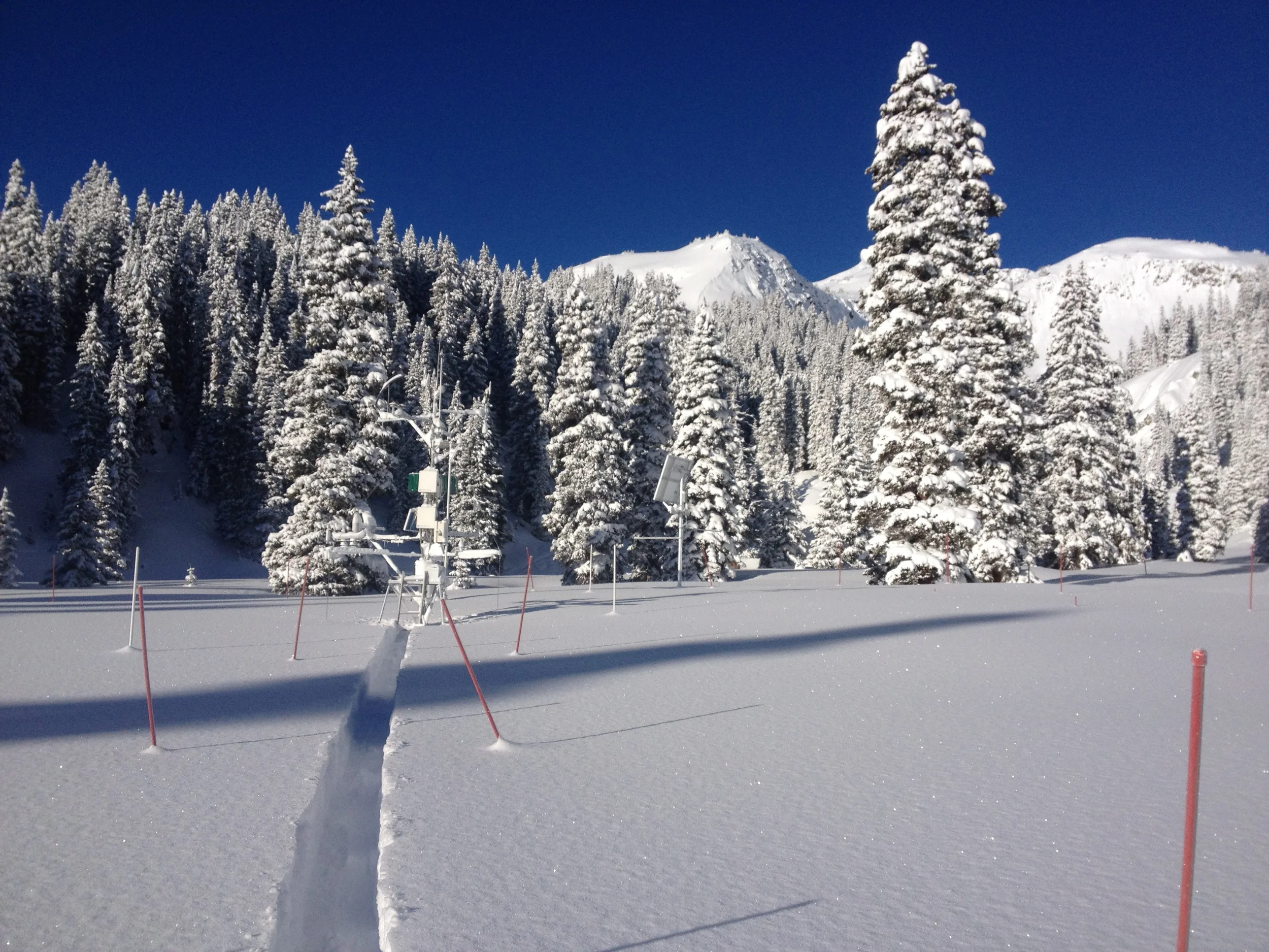
As of close examination of the snowpack at Swamp Angel Study Plot yesterday, I can confirm that Storm #8 did not deliver any dust to Senator Beck Basin. Thus, we have yet to observe any dust-on snow events so far this season.
During Storm #8 the Winslow, Arizona airport measured at least 0.2" of precipitation (as rain and snow), indicating that at least some portions of the Little Colorado River basin saw some soil moistening/wetting. Farther north, views from the USGS web cameras at Mesa Verde,Abajo Peak, and Island in the Sky showed significant snow on the ground after the storm cleared.
Now, as hoped, Storm #8 is going to be followed by another significant winter storm starting tomorrow (Friday), for the San Juan Mountains and some Central Mountain locations at least. NWS Grand Junction is warning of new snow amounts in the 2-4 foot range for the San Juan locations favored by southwest flow. SW'ly winds may also be strong, at times, during this storm. Normally, this predicted strong SWly wind field could be suspected to carry dust.
Fortunately, this approaching storm may also produce significant rain and snow amounts in northeastern Arizona that may preempt dust emissions. (Southeastern Utah still retains substantial snowcover that will also preclude dust emission). Here's the advisory for the approaching storm and a second, following storm, issued by the NWS Flagstaff office earlier today:
HAZARDOUS WEATHER OUTLOOK
NATIONAL WEATHER SERVICE FLAGSTAFF AZ
434 AM MST THU FEB 26 2015
.DAYS TWO THROUGH SEVEN...FRIDAY THROUGH WEDNESDAY
A FEW LIGHT RAIN AND SNOW SHOWERS ARE POSSIBLE ACROSS EASTERN
ARIZONA THURSDAY AFTERNOON.
FROM FRIDAY AFTERNOON THROUGH MONDAY...A TROUGH WILL MOVE INTO THE
SOUTHWEST UNITED STATES...BRINGING RAIN AND HIGHER ELEVATION
SNOW TO NORTHERN ARIZONA. SNOW LEVELS DURING THIS TIME ARE
EXPECTED TO RANGE FROM 5000-6000 FEET OVER THE KAIBAB
PLATEAU...6500-7500 FEET AROUND FLAGSTAFF...TO 7000-8000 FEET FOR
THE EASTERN MOGOLLON RIM AND WHITE MOUNTAINS. LOWER ELEVATION
RAINFALL AMOUNTS OF 1-3 INCHES POSSIBLE WITH THE HIGHER AMOUNTS
OVER THE MOGOLLON RIM...WHITE MOUNTAINS AND GILA COUNTY. SNOWFALL
OF 6-18 INCHES POSSIBLE FOR THE HIGHER ELEVATIONS. SIGNIFICANT
RISES COULD ALSO OCCUR ALONG STREAMS AND RIVERS...ESPECIALLY SOUTH
OF THE MOGOLLON RIM.
TUESDAY INTO WEDNESDAY...A COLDER SYSTEM COULD AFFECT THE
REGION...BRINGING ANOTHER ROUND OF HEAVY PRECIPITATION. SNOW
LEVELS COULD BE AS LOW AS 4-5 THOUSAND FEET. ADDITIONAL HEAVY
SNOW ACCUMULATIONS POSSIBLE FOR THE HIGHER ELEVATIONS...AND
SIGNIFICANT RAINFALL FOR LOWER ELEVATION AREAS.
THIS HAS THE POTENTIAL TO BE A LONG DURATION RAIN AND SNOW EVENT
FOR NORTHERN ARIZONA...WITH MAJOR TRAVEL IMPACTS. RESIDENTS AND
VISITORS ARE URGED TO PAY CLOSE ATTENTION TO THE LATEST
FORECASTS...AND BE PREPARED FOR SIGNIFICANT RAIN AND SNOW.
Given this heavy precipitation expected over much of the Colorado Plateau, there is at least some cause for hope that these storms will deliver only wanted snow and water, and no unwanted dust ... we will be watching and report.
More soon,
Chris