CODOS UPDATE JANUARY 23, 2026: refresh on the way, long way to go
Greetings from Silverton,
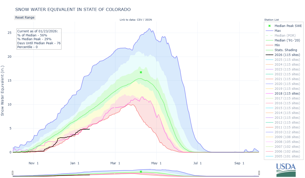
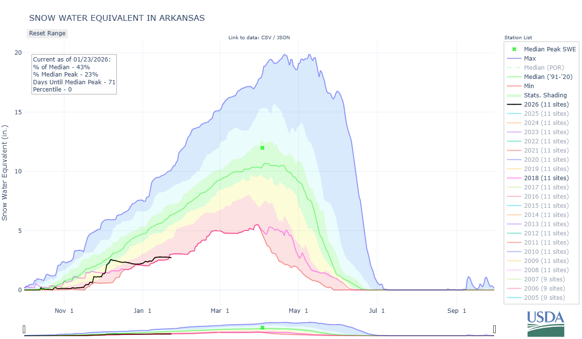
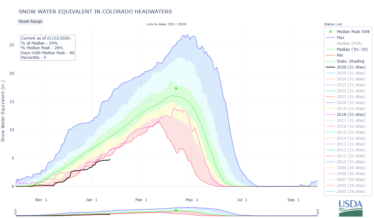
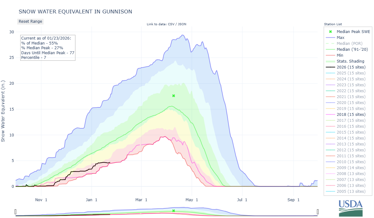
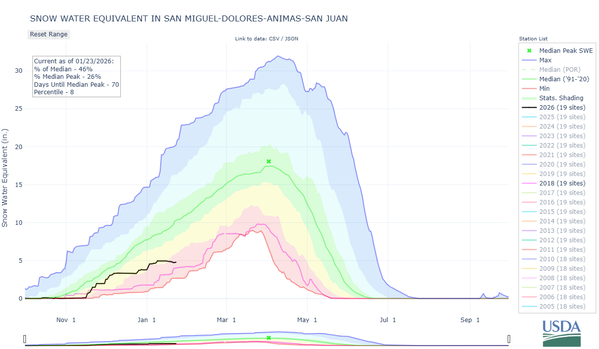
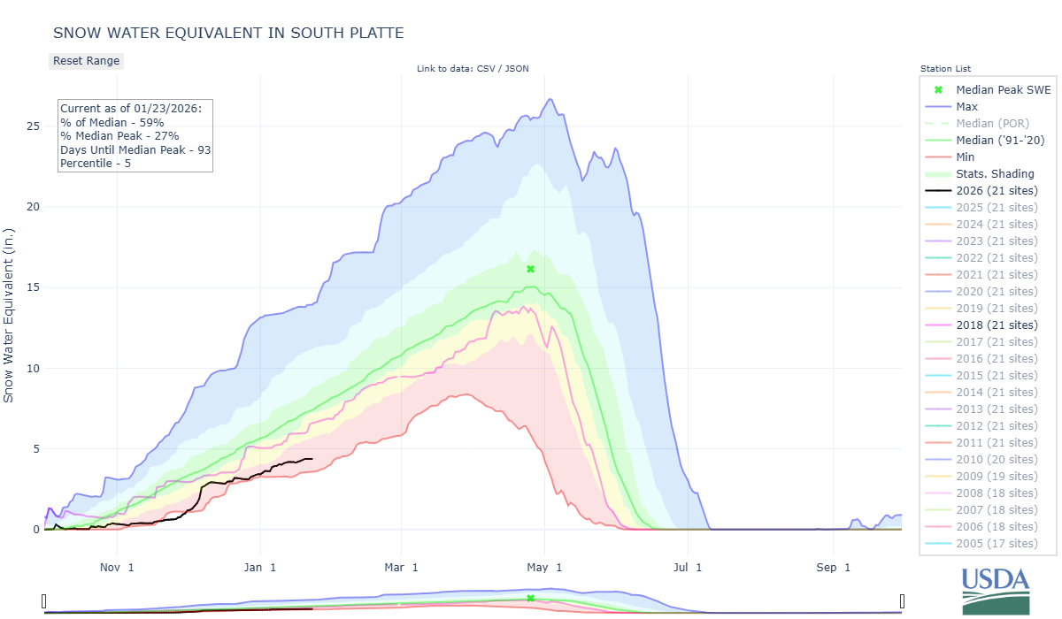
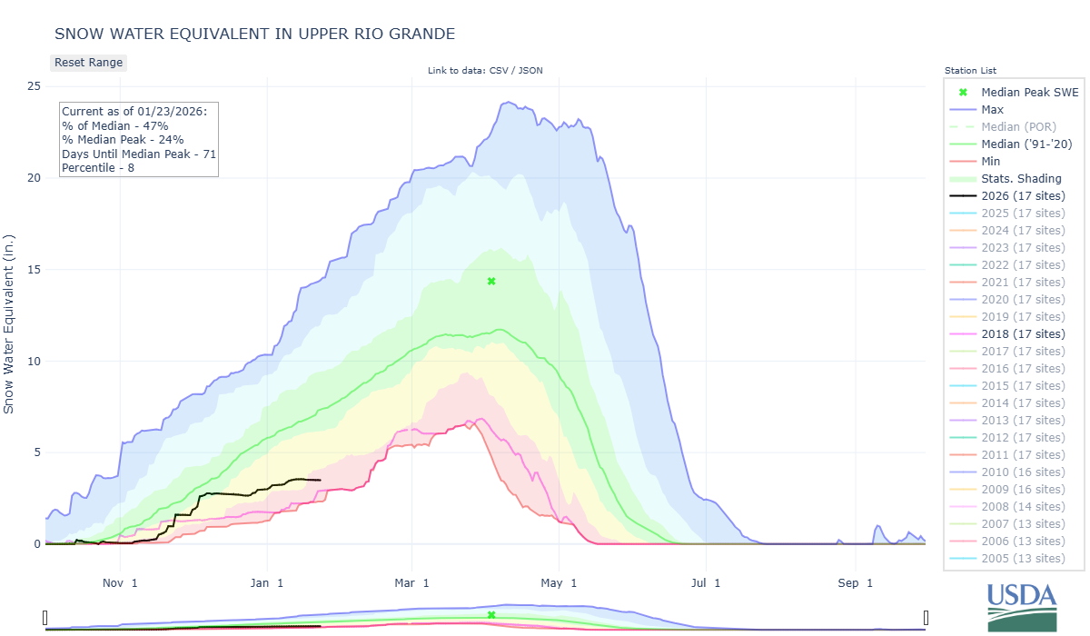
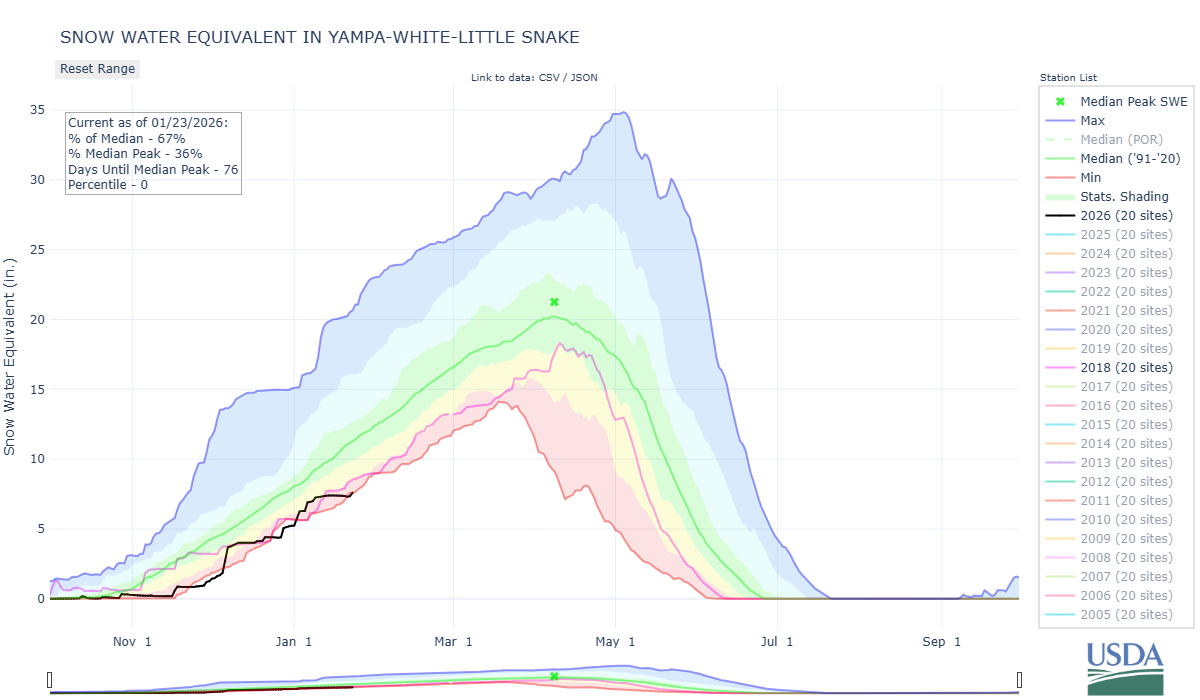
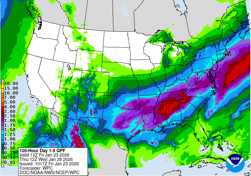
Mid-January the state of Colorado as a whole began setting record lows for snow water equivalent. The Arkansas and Colorado Basins have dipped firmly into record lows while the Gunnison and Yampa are hovering right at record low, and the South Platte, Rio Grande, and San Miguel/Dolores/Animas/San Juan are firmly in the red. For a point of reference, except for the South Platte, WY2018 established new record snowpack lows or very close to it across the Colorado Mountains. Currently, there are a few Southern Basins trying hard to stay out of that territory but we are pretty much at WY2018 levels or worse. Varying snowfall forecast totals for the upcoming storm starting today thru the weekend are leaving us with some hope for a decent refresh, but its not looking like the start of a major comeback.
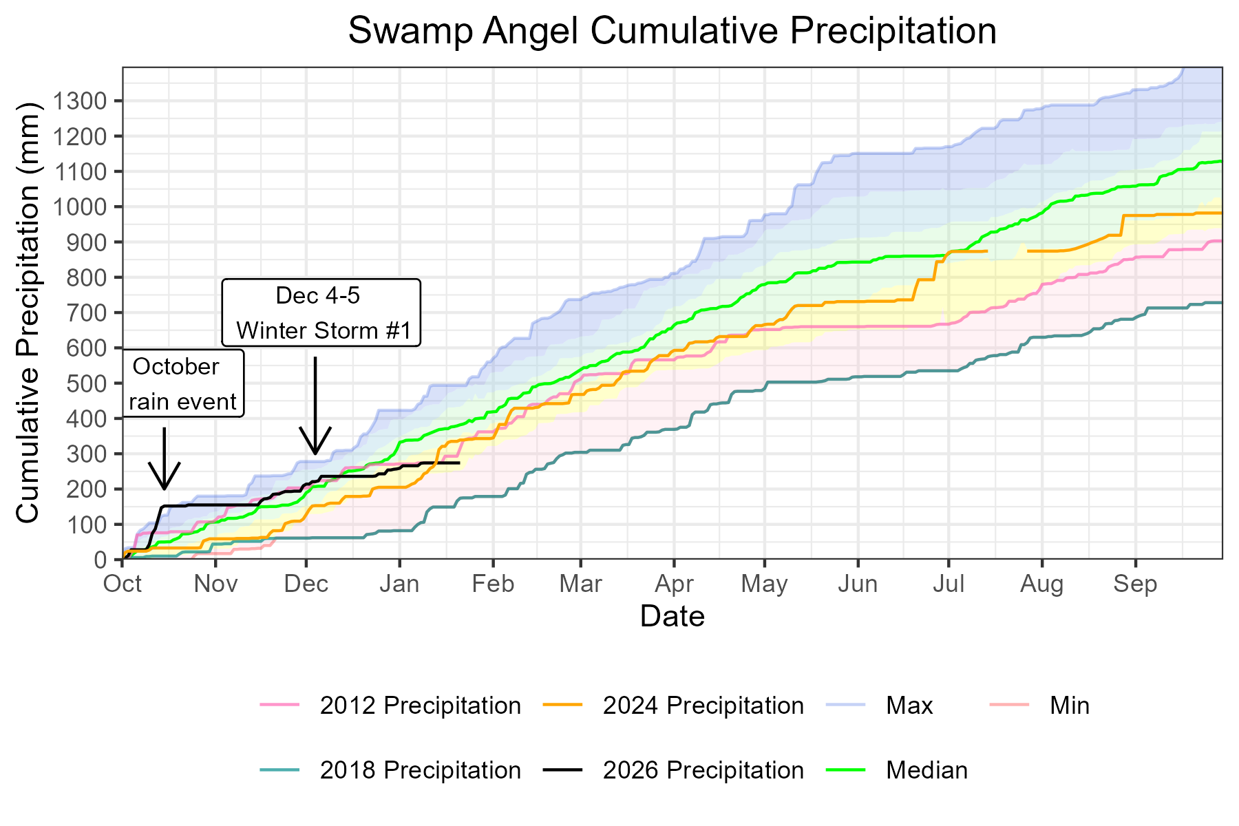
Often when there is a lack of snow to discuss, there is also a lack of dust. When we at CSAS see high winds, we think dust, particularly out of the Southwest where our dust events tend to arrive from. This winter, we have had four winter storms at Swamp Angel, and prevailing winds during those storms were out of the west, southwest, and south. Putney Station (12,323’) clocked some windy conditions on January 16-17th, primarily out of the north, which hammered the snowpack above treeline in the San Juans (see wind rose below). With have just a few storms under our belt, our snowpack is currently dust-free.
Please see plots below.
SNow School for Water Professionals
Snow School is a go. We are really excited to offer Snow School for Water Professionals for another winter season. This year the class will be held February 25 - 27, 2026. The class is perfect for anyone wanting to learn more about the role of snow and our mountain environments as it pertains to water resources, designed to enhance understanding of snowpack processes, snow monitoring and data.
Plus, we will have guest lectures by Colorado Water Conservation Board staff about the Weather Modification Program as well as the Colorado Airborne Snow Measurement Program (CASM).
And, we will get a personalized tour of Red Mt SNOTEL by NRCS staff!
The combination classroom and field course will begin on Wednesday morning at our office in Silverton and end on Friday afternoon (2.5 days). . Click here to download flyer, please circulate in your workplace forward announcement to folks you think might be interested. You can pay with credit card at snowstudies.org. Please do not hesitate to contact me with questions.
Take Care
Below: Plots of SWE for major Colorado Basins as observed by SNOTEL stations. WY2018, a recent and notorious dry winter is shown in pink.
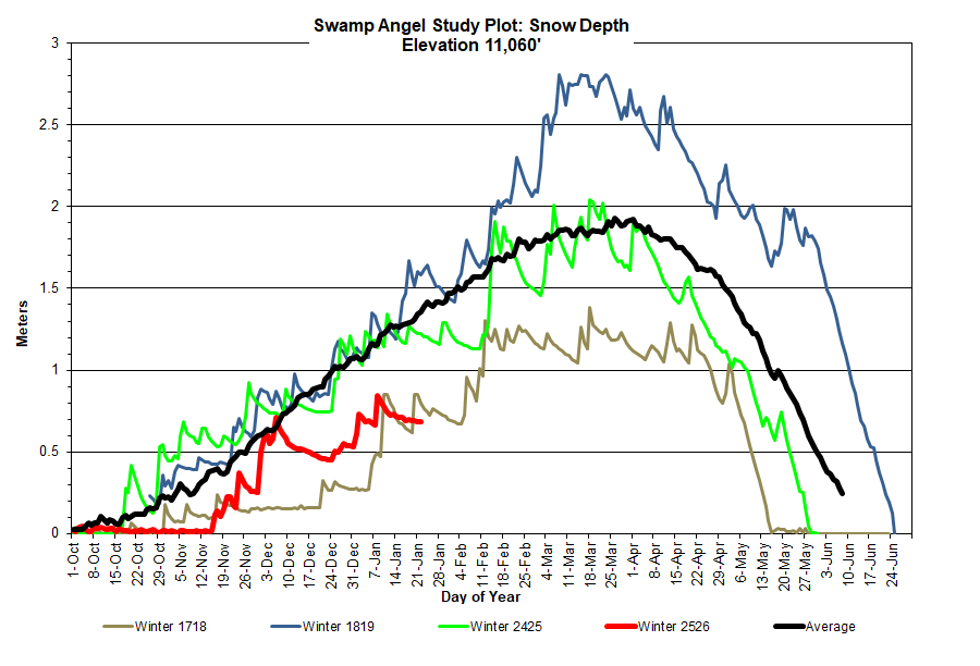
Below: Snow depth at Swamp Angel is 2.2 feet, with 6.8 inches of SWE. Cumulative water year precipitation at that site is approximately 72% of the median, but this is bolstered by the October rainstorms at the beginning of the water year, and misleads the read of the snowpack. However, while it doesn’t feel like the dead of winter with these moderate temps and lack of snow, we have our historically snowiest months ahead of us.
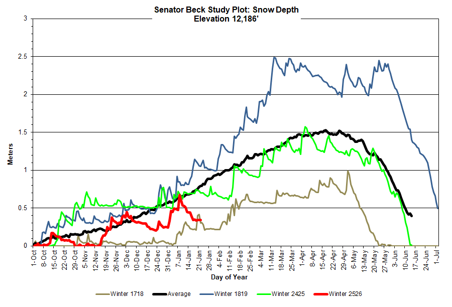
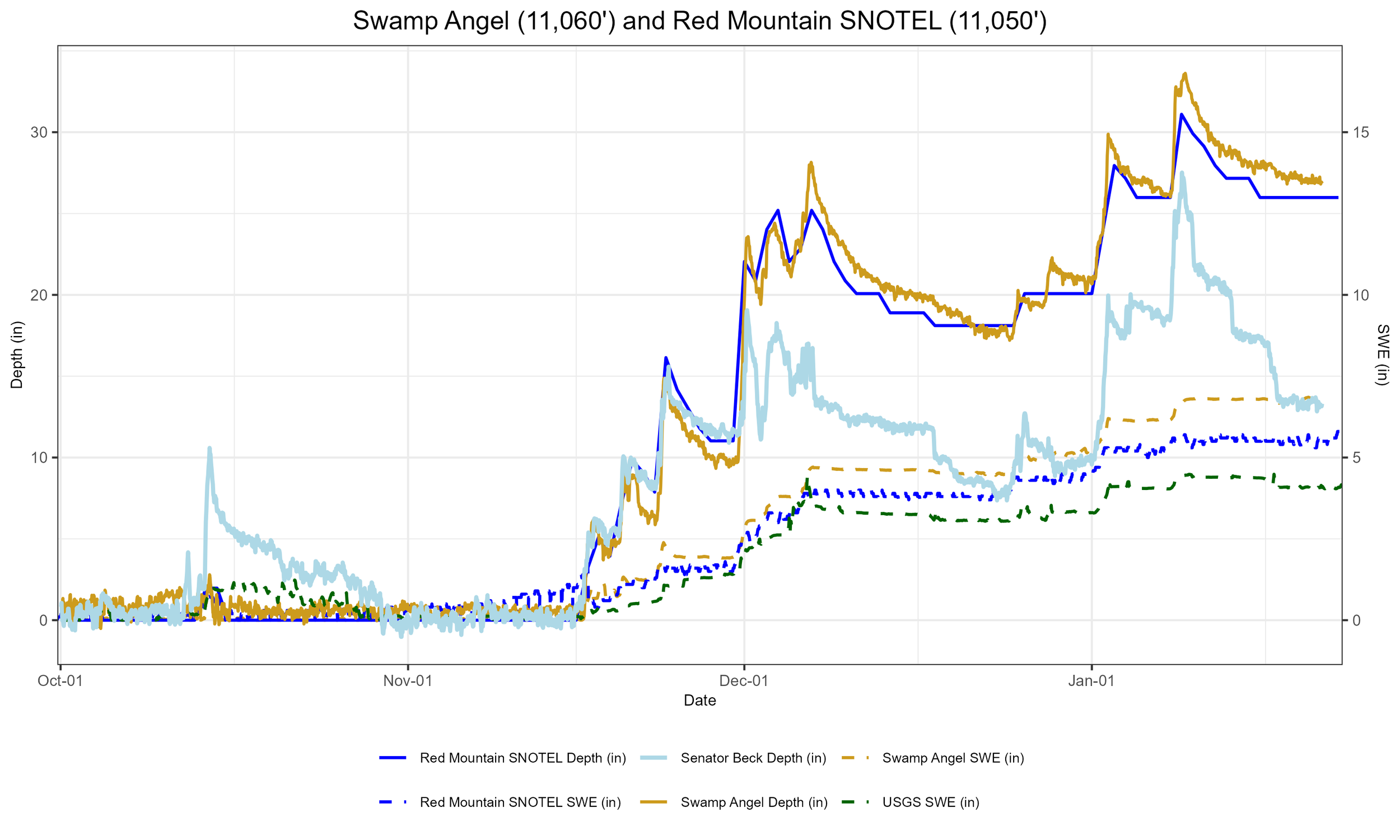
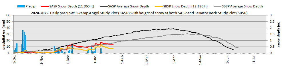
Above: Plot of snow depth and precipitation at Senator Beck Basin
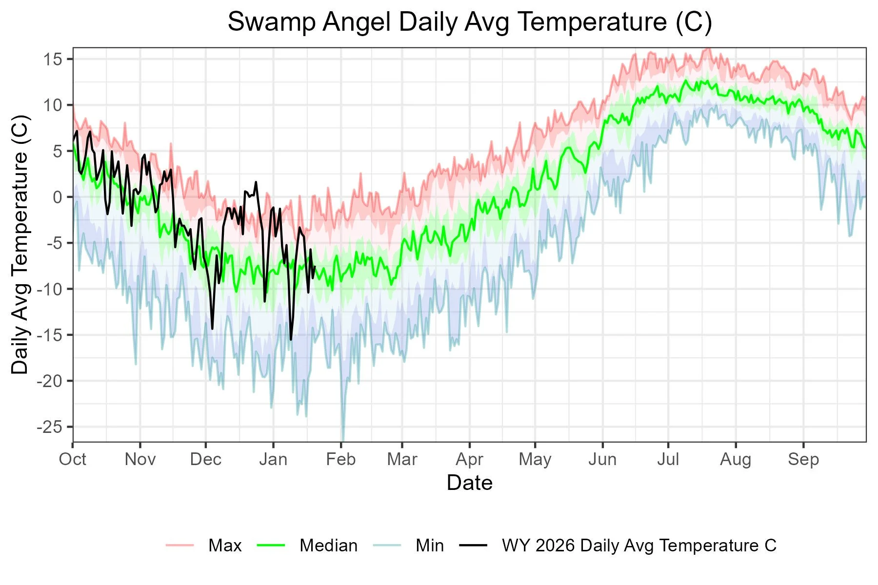
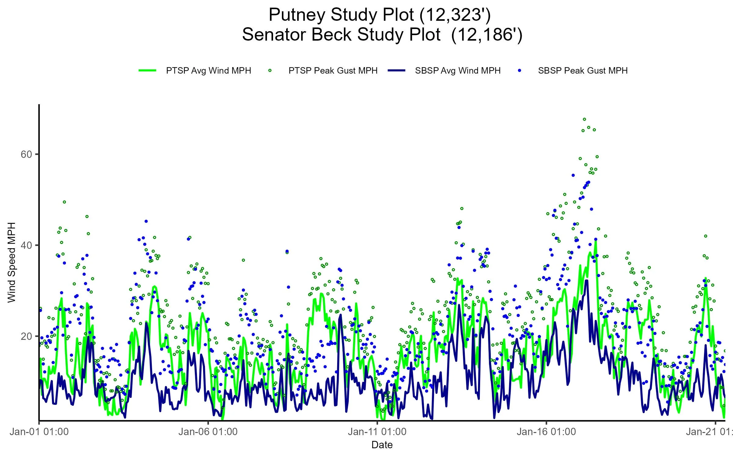
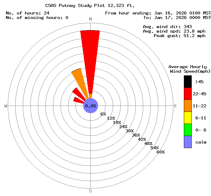
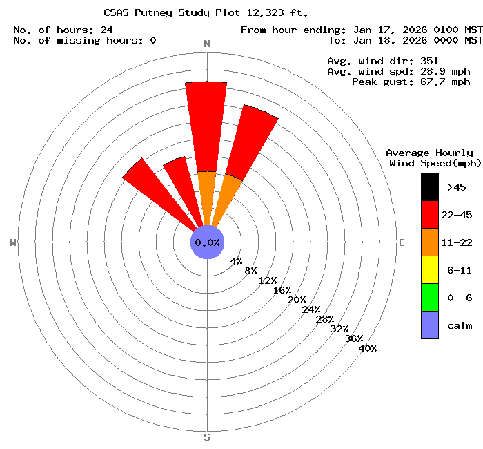
Above: We are still experiencing unusually warm temps for this time of year. We also had some high winds mid-January out of the north, with peak gusts up to 67.7 mph at Putney Station (12,323’).
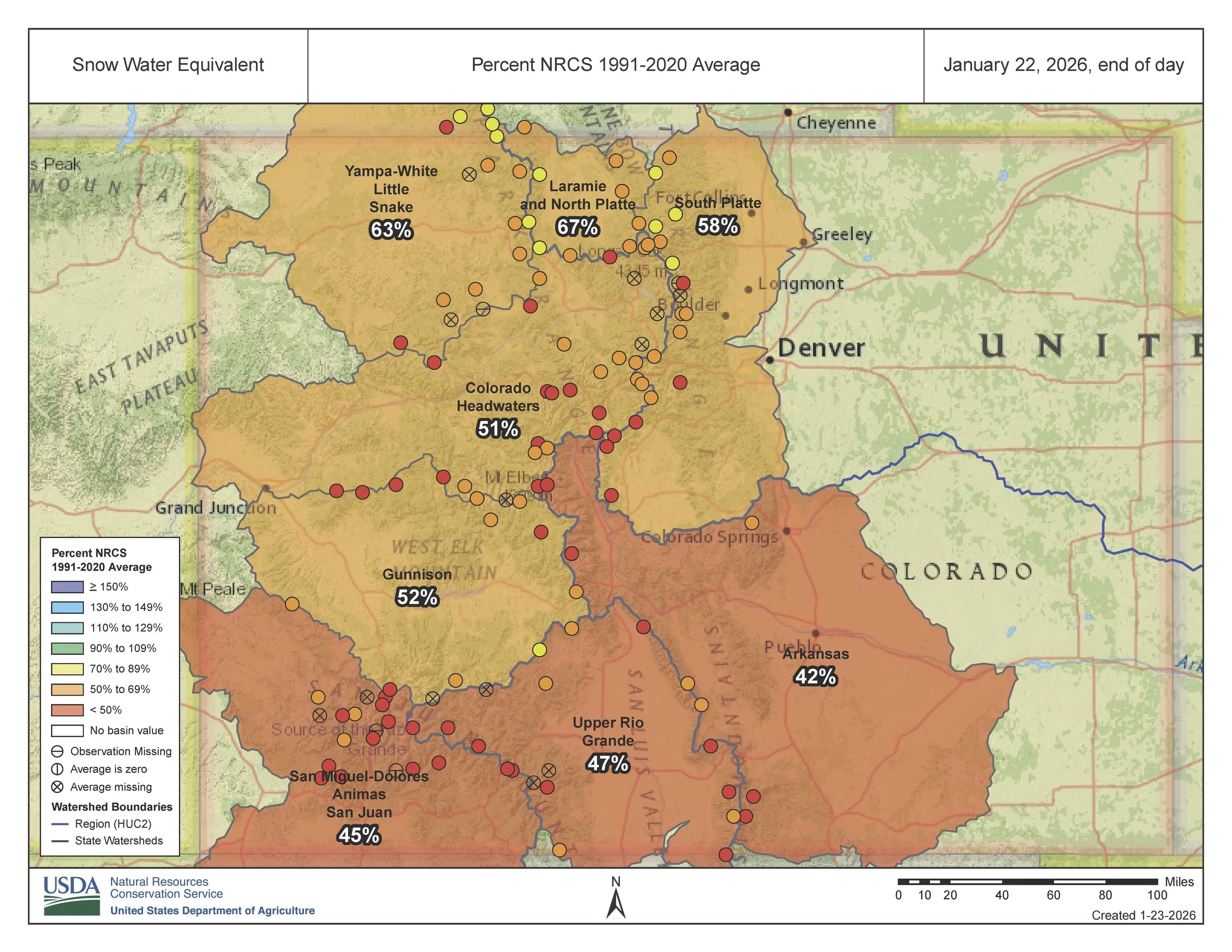
Above: The Colorado snowpack is seriously struggling.
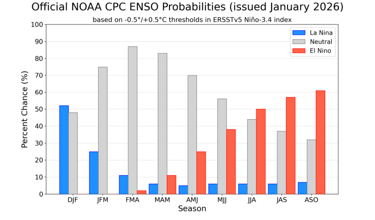
Below: I think we’ve all had enough of La Nina, so this slow transition back to neutral and a likelihood for an El Nino is a welcome change.